fbpx
 

Standard Property Maps

Make Your Property a Safe Haven for Wildlife
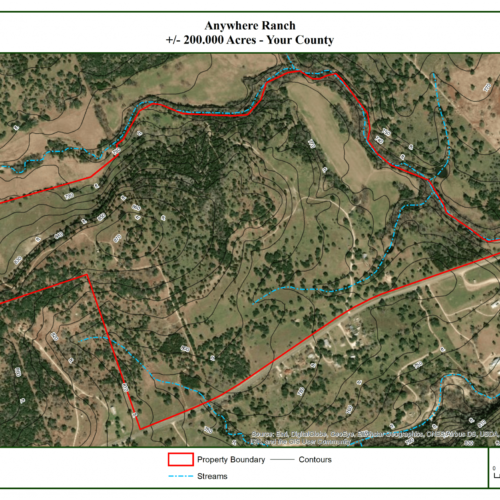
Cedon_Realty_Marketing_Standard_Map

PRODUCT DESCRIPTION

Maps are an essential tool for any landowner. From roads and water features, to soil types and hydrology, it’s important to know exactly where your property features and assets are located.

Plateau maps help you see your land from a new perspective, and even identify previously unrealized value. Property maps are also great tools for touring or working on your property, visualizing strategic goals for your land, and enhancing communication between landowners and ranch managers / construction foremen / hunters, etc. Professionally designed with the latest GIS technology, you’ll be proud to display your Plateau map in your home, ranch or business.
Standard Property Maps


$365 plus tax


Standard Map: $365 (archival, lamination or vinyl)
$100 per copy; $30 for additional 11” x 17”

Call to OrderCall to Order Email to OrderEmail to Order
Still Have Questions? Call us at (512) 894-3479
  • Maps are 2 feet x 3 feet
  • Property boundary with most recent aerial and topographic imagery as background
  • Additional Layer Options
    • Hydrology
    • Ecological Sites
    • Soils
    • Elevation Contours
    • For Plateau clients, any GPS points we’ve previously collected on your property (nest box and feeder locations, fire ant treatments, etc.)
X